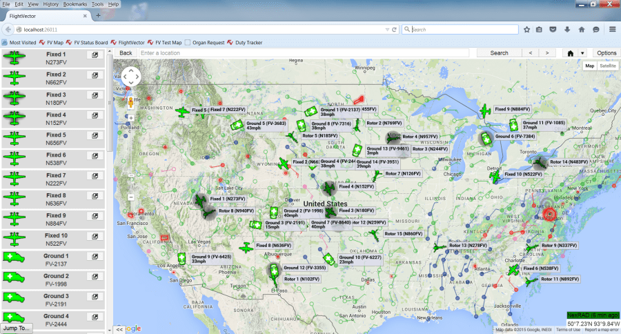
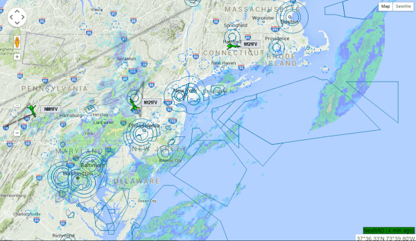
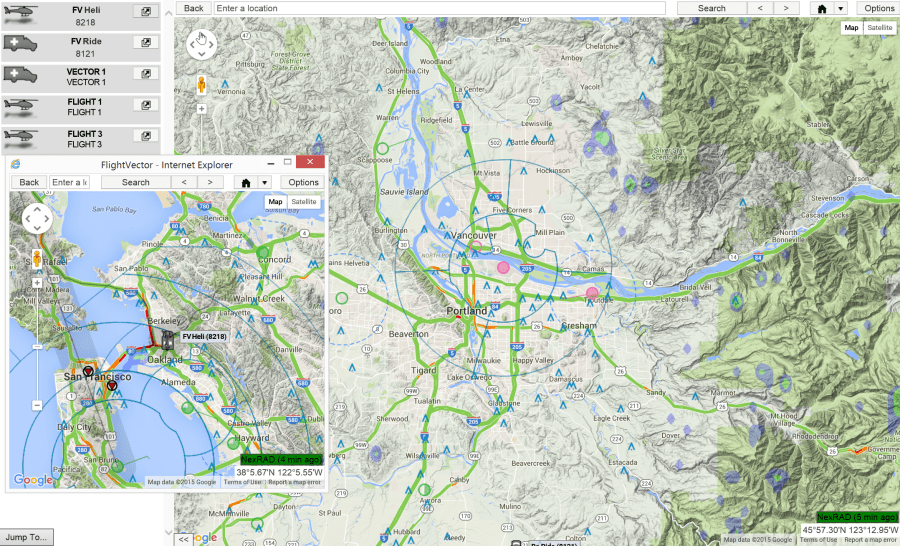
Flight Vector™ Map provides the user with enhanced situational awareness of the organization’s operations by providing:
- A complete overview of all assets and their current locations
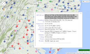
- Real-time weather and airspace restrictions
- Current ground traffic conditions
- Current operational request information.
- The map is able to obtain global positioning information from any tracking service and display this information on one map, eliminating the need to run multiple maps from multiple tracking companies.
- Collision potential warnings for any FV tracked asset.
- Notification of asset emergency squat switch activation.
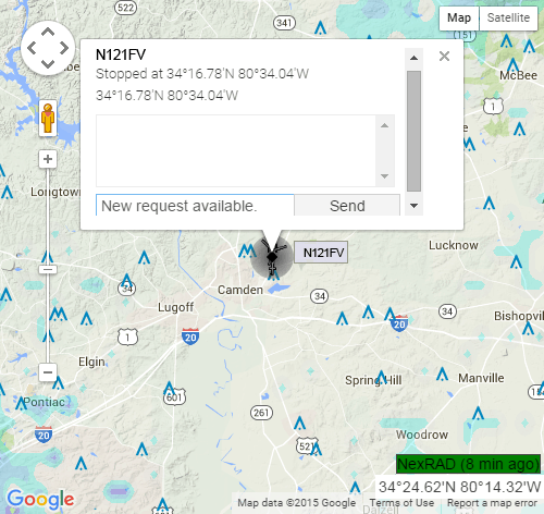
The map is able to communicate with the tracking system through text messaging as long as the feature is supported by the tracking system. Simply click on the asset to see the messages sent to the asset or type a message to send to the asset.
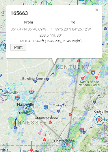 When a request needs a helicopter, the map will automatically determine the MSA (Minimum Safe Altitude) for each leg of the request as soon as it is added to the CAD. The user can just click on each leg of the flight to see the MOCA (Minimum Obstacle Clearance Altitude) and also see the clearance altitude needed for both day and night flights based on the clearances set by the organization’s administrator.
When a request needs a ground vehicle, the map will show the route along the streets. The user can also see current traffic information and the time to reach the destination takes the current traffic into consideration to determine the ETA.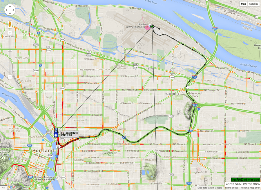
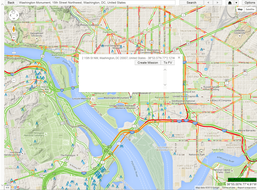
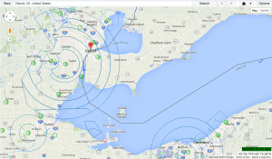
Google™ maps is our base map for our product and all additional layers are drawn on top of their map. This allows the map to use the very powerful search engine from Google so you can find any location in the world!
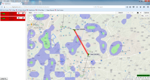
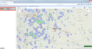
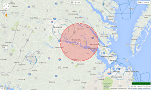
Our map draws NEXRAD, METARs, TAFs, Airspace, Obstacles, Wind direction and Wind speed, Routes, TFRs and GeoFence (user defined areas on the map) information as layers on the map. Each layer can be turned on or off very easily. This allows you to configure the map to your preferences.
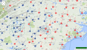
A list of each asset currently being tracked is display on the left side of the map. Users can simply click on an asset to center the map on that asset. Additionally, the user to open a new window for that asset that continually displays the selected asset centered in the window while moving and allows the user to view others areas on the full map.
When the map is used with our CAD system it is very simple for the user to search for a location and then send this location to the CAD to become the “pick up” location for the request. This is a very powerful feature of our software as it eliminates the possibility for a user to make a mistake on the location when entering it into the CAD. With the map the user can view the selected location to verify it is correct before sending the information to the CAD. This can eliminate sending an asset to the wrong location!
Since Google™ maps are the base map, you can select to view the map in the Google™ map view or the satellite view.

An additional situational safety feature is that Flight Vector™ Map will display potential asset collisions for any tracked Flight Vector asset and emergency squat switch activation. The collision warning and emergency squat switch activation are both visual and audio warnings.